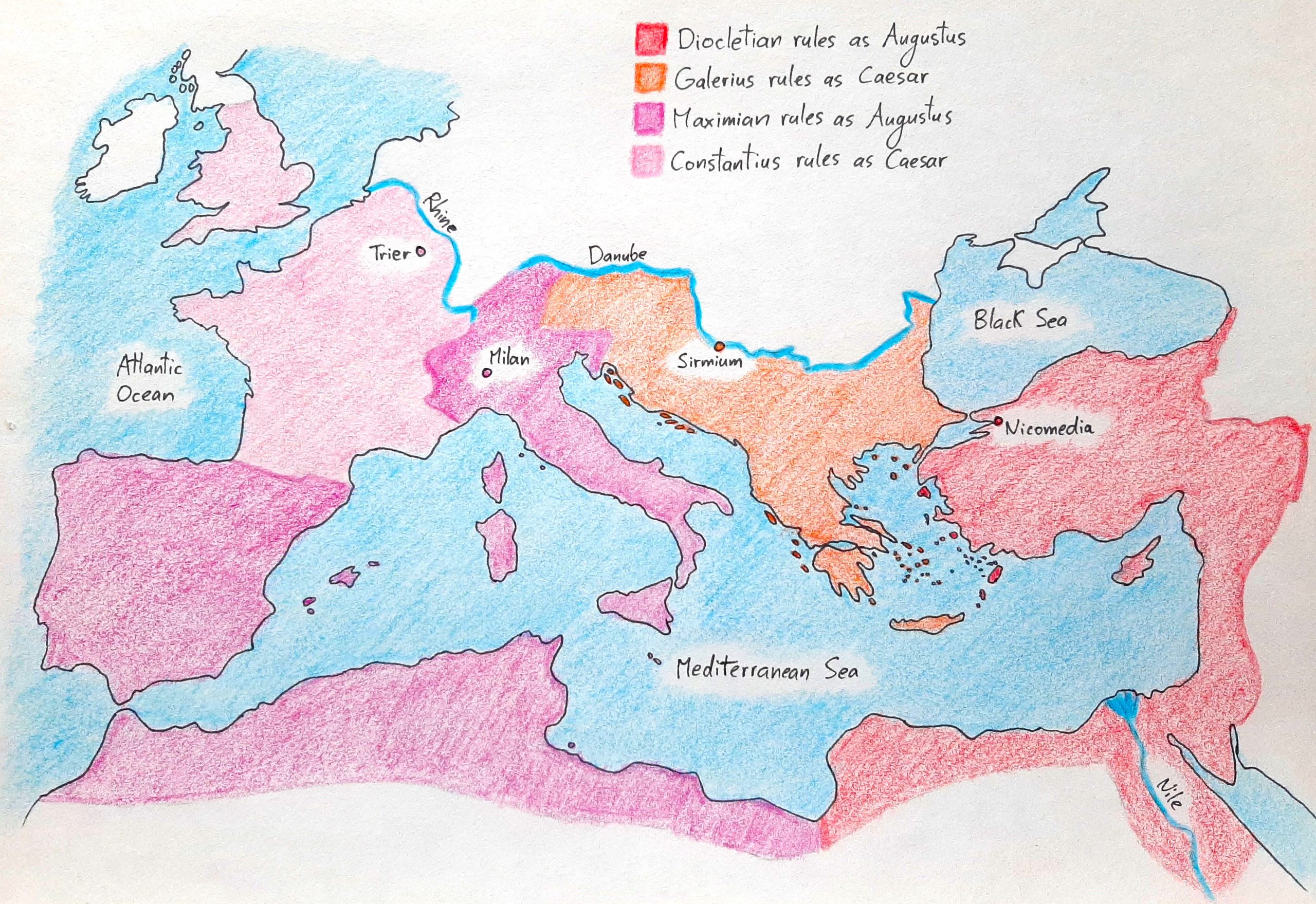
Below, you can see Diocletian’s reformed empire in the year 300 CE. The Mediterranean world was divided into four regions, each ruled by an emperor with a capital near the border.
Diocletian oversaw the eastern part, which combined Anatolia, Syria, Palestine, and Egypt. His heir, Galerius, governed the Danubian district, which united Pannonia, Moesia, and Thrace.
Maximian ran the Mediterranean sector, which combined Hispania, Africa, and Italia. His heir, Constantius, administered the western region, which united Britannia, Gaul, and Germania.
The map below zooms in on the Lower Danube, a region which was ruled by Galerius. You can see the borders of the original province of Dacia, as well as its roads and cities.
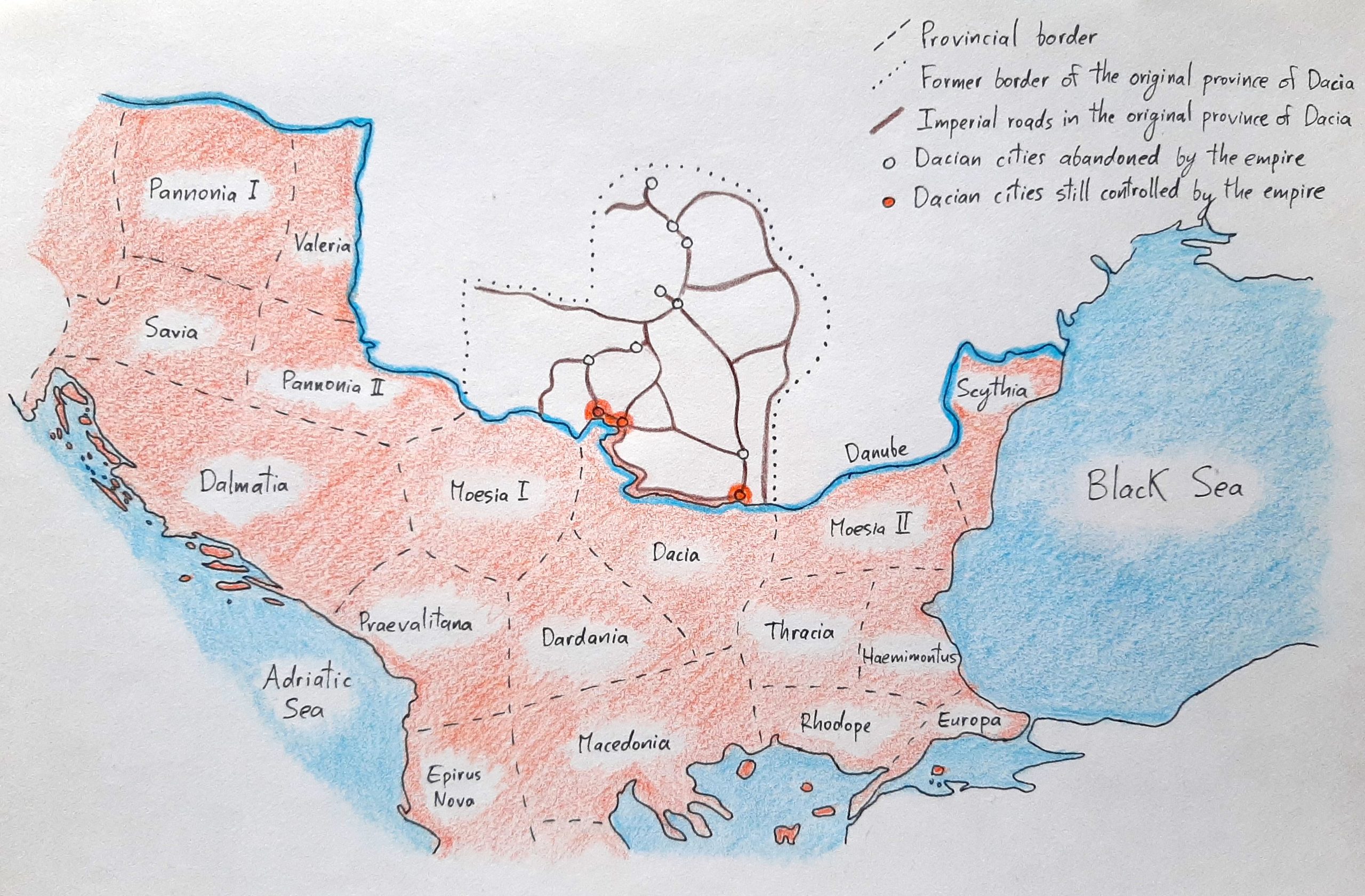
The new, smaller province of Dacia established by Aurelian lies south of the Danube; it included three cities north of the river which had remained under Roman control, and it’s through these cities that the empire continued to trade with the people beyond the Danube.
You can also see the provinces created by Diocletian in the region. Most pertinent to our story is that Moesia Superior and Moesia Inferior no longer exist; Aurelian took territory from the two of them to create his new Dacia, and Diocletian renamed them Moesia I and Moesia II. Part of Moesia II was taken to create Scythia, a province named after the ancient nomadic peoples we’ve seen at the beginning of our story.
Leave a Reply