Look through all the maps I’ve drawn for the story in chronological order.
-
791 CE – Charlemagne’s realms bordering the khaganate
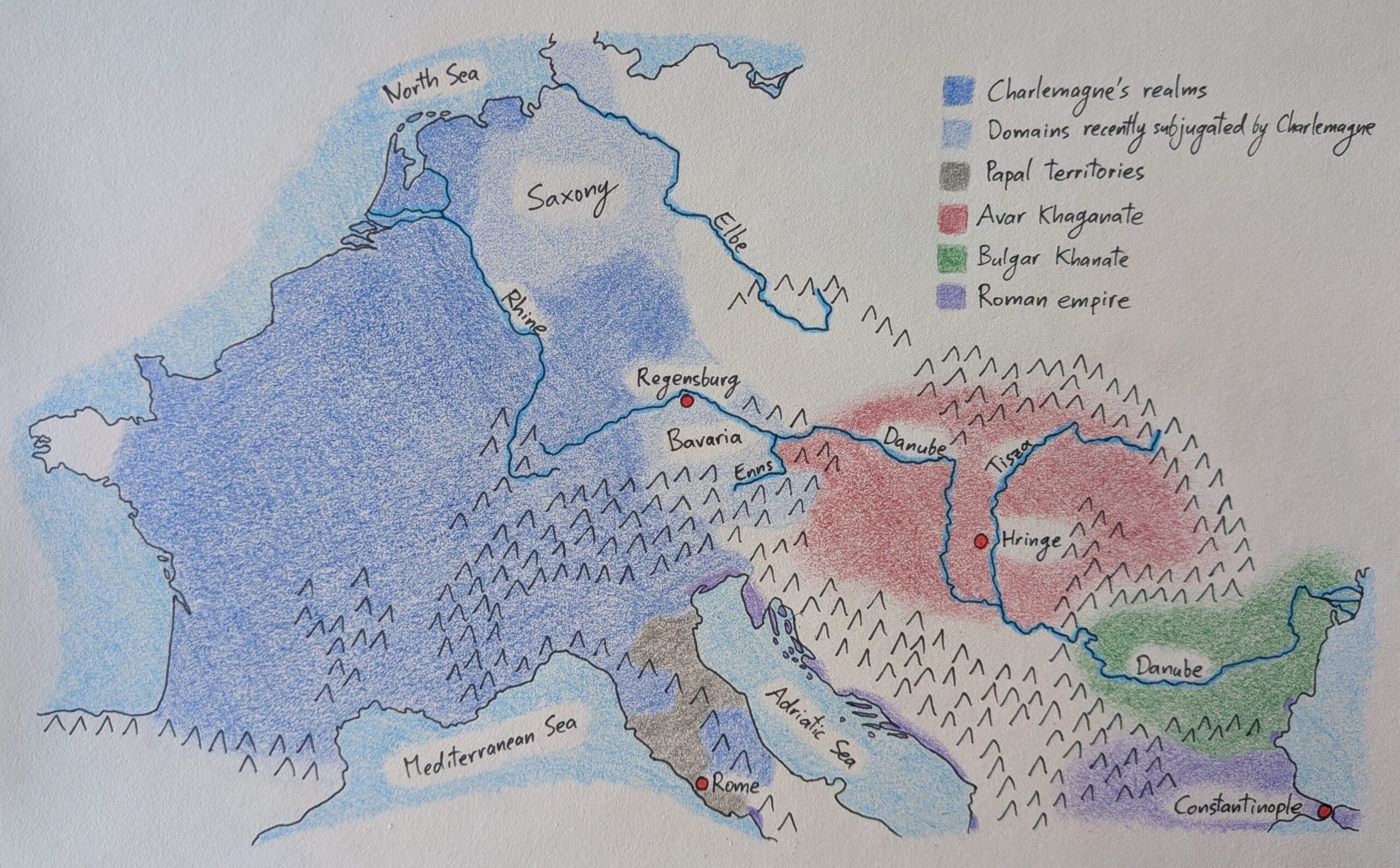
After decades of campaigning, the Frankish king had expanded his dominion from the Atlantic to the Adriatic and became the most powerful ruler in the region in centuries. Two territories of particular interest for our story are Saxony and Bavaria. Charlemagne had campaigned against the Saxons for years until, in 785, he had defeated their…
-
705 CE – Bulgar khanate, ally of the empire
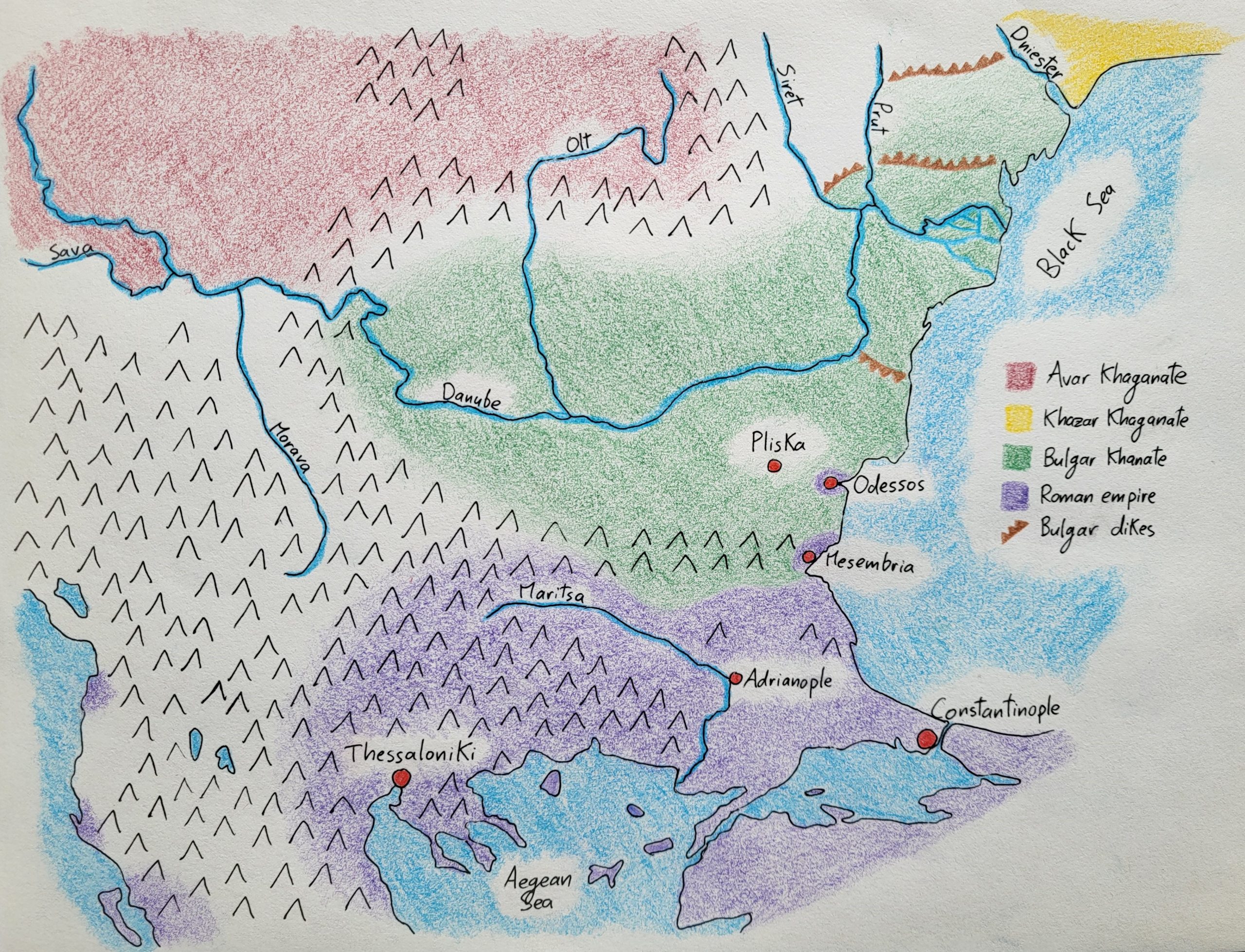
Khan Asparukh had fled from the Khazars with his followers, found refuge between the Danube and the Balkan Mountains, and in 681, he forced the Roman empire to allow his people to settle in the area. Over the following two decades, he expanded his realm westwards towards the Iron Gates – the point where the…
-
681 CE – The founding of the Bulgar khanate
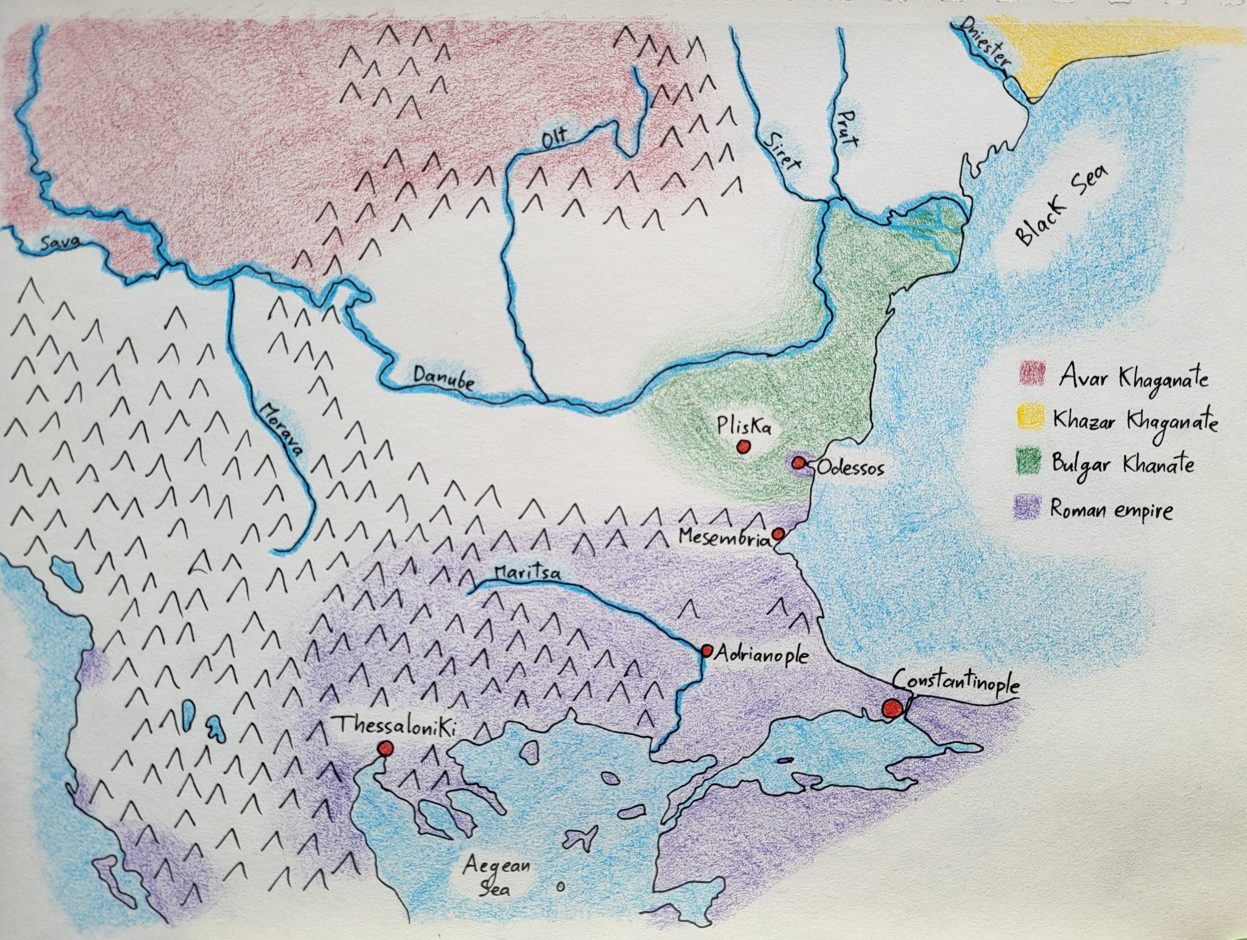
The Balkans welcomed a new player in the late seventh century with the arrival of Asparukh’s Bulgars, who were fleeing the Khazar invasion of their steppe lands. The Khazars ruled a khaganate which ran from the Caspian Sea in the east to the Dniester River in the west, and from the Caucasus Mountains in the…
-
670 CE – The renewed Avar khaganate
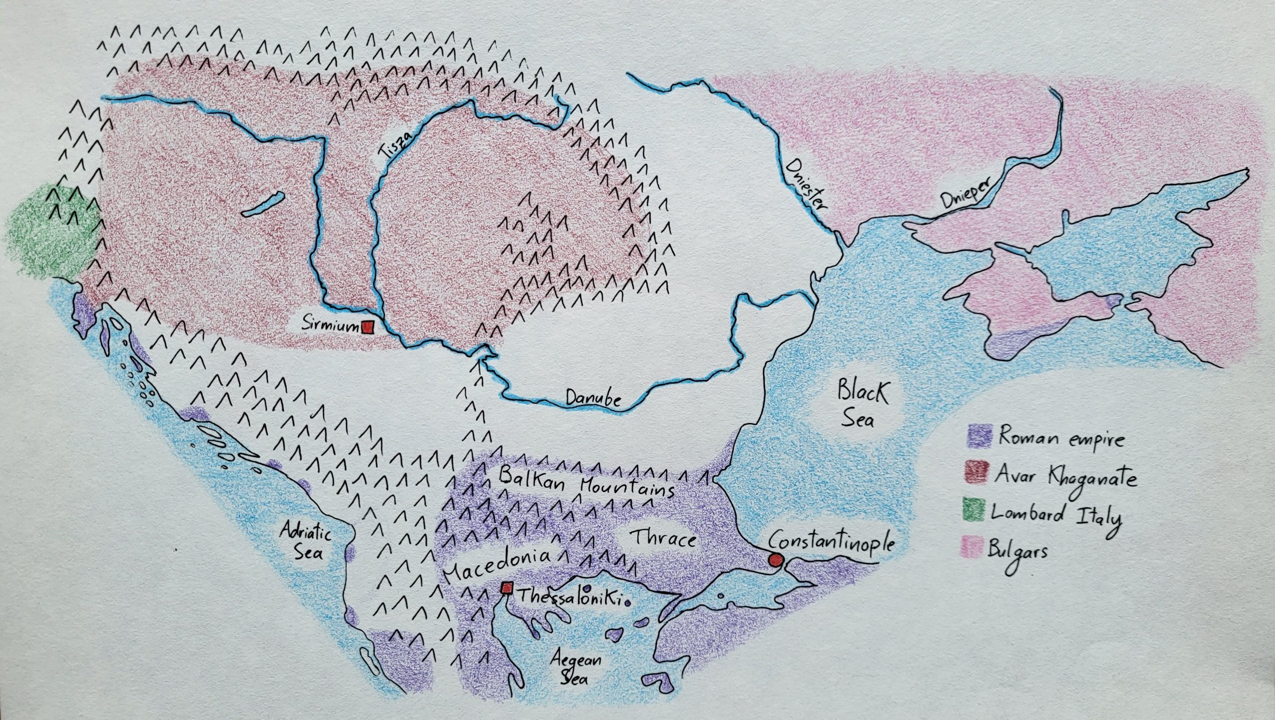
The Avars experienced a comeback in the later seventh century after the low point of the 630s when parts of the khaganate had broken away in the West and East. When Samo of the Slavs died in 660, his realm splintered between his squabbling sons, and so the Avars were able to subjugate each small…
-
635 CE – The reduced Avar khaganate
The Avar khaganate in 635 was much reduced compared to what it had been a decade earlier. Following the khagan’s defeat at Constatninople in 626, the Slavic clans in the West rebelled and elected Samo as their king, thus establishing an independent realm along the Morava River. Meanwhile, a faction of Bulgars sought to dethrone…
-
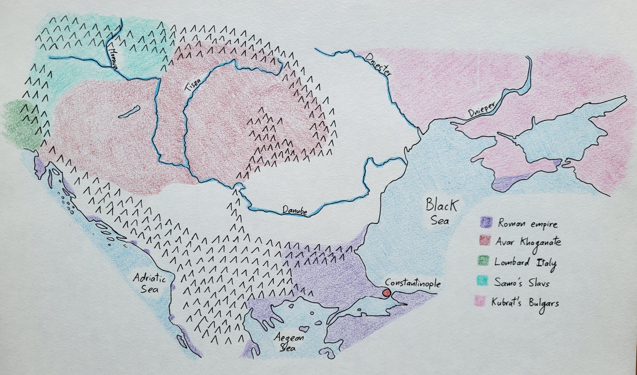
602 CE – The Avar khaganate
A snapshot of the Balkans after the Romans stabilized the Danube frontier in 602 CE. Though the Avars controlled lands from the Alps to Crimea, they had mostly settled their families on the Pannonian Plain (the grasslands on either side of the Middle Danube, basically where the river takes a sharp bend north of Sirmium).…
-
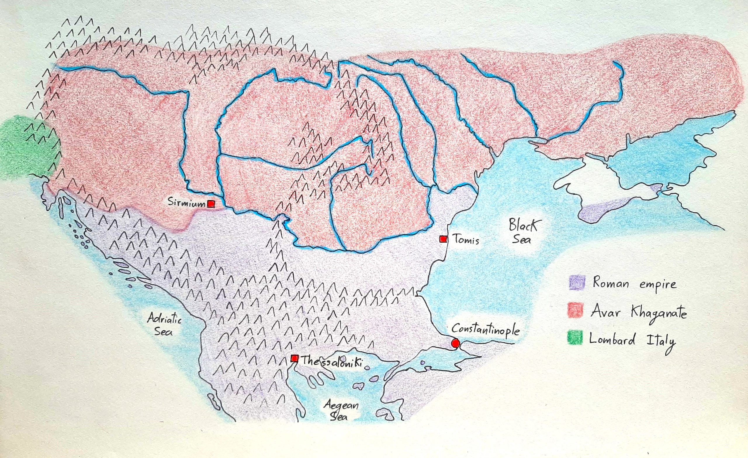
552 CE – The Gepids and Lombards
Here’s what the region looked like after the Lombards settled west of the Gepids at Justinian’s invitation. Note how the Gepids held lands along the south bank of the Danube to better protect their capital at Sirmium, and how the Romans still held the city of Sucidava on the north bank of the river, such…
-
535 CE – The Balkans during Justinian’s reign
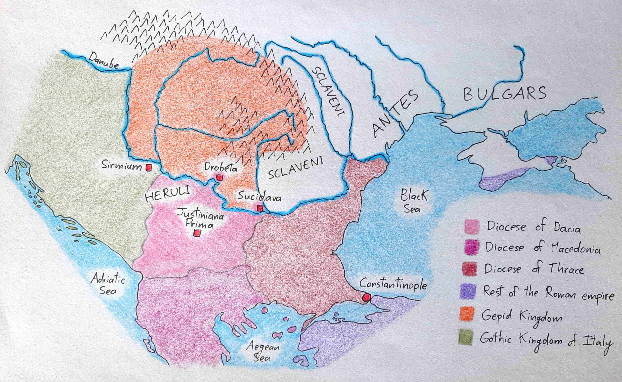
Here’s what the Balkans looked like in 535 CE just after emperor Justinian inaugurated Justiniana Prima, his new city in the middle of the Diocese of Dacia that acted as the centrepiece of his defensive system in the region. Note the key cities on either side of the Danube, as well as the arrival of…
-
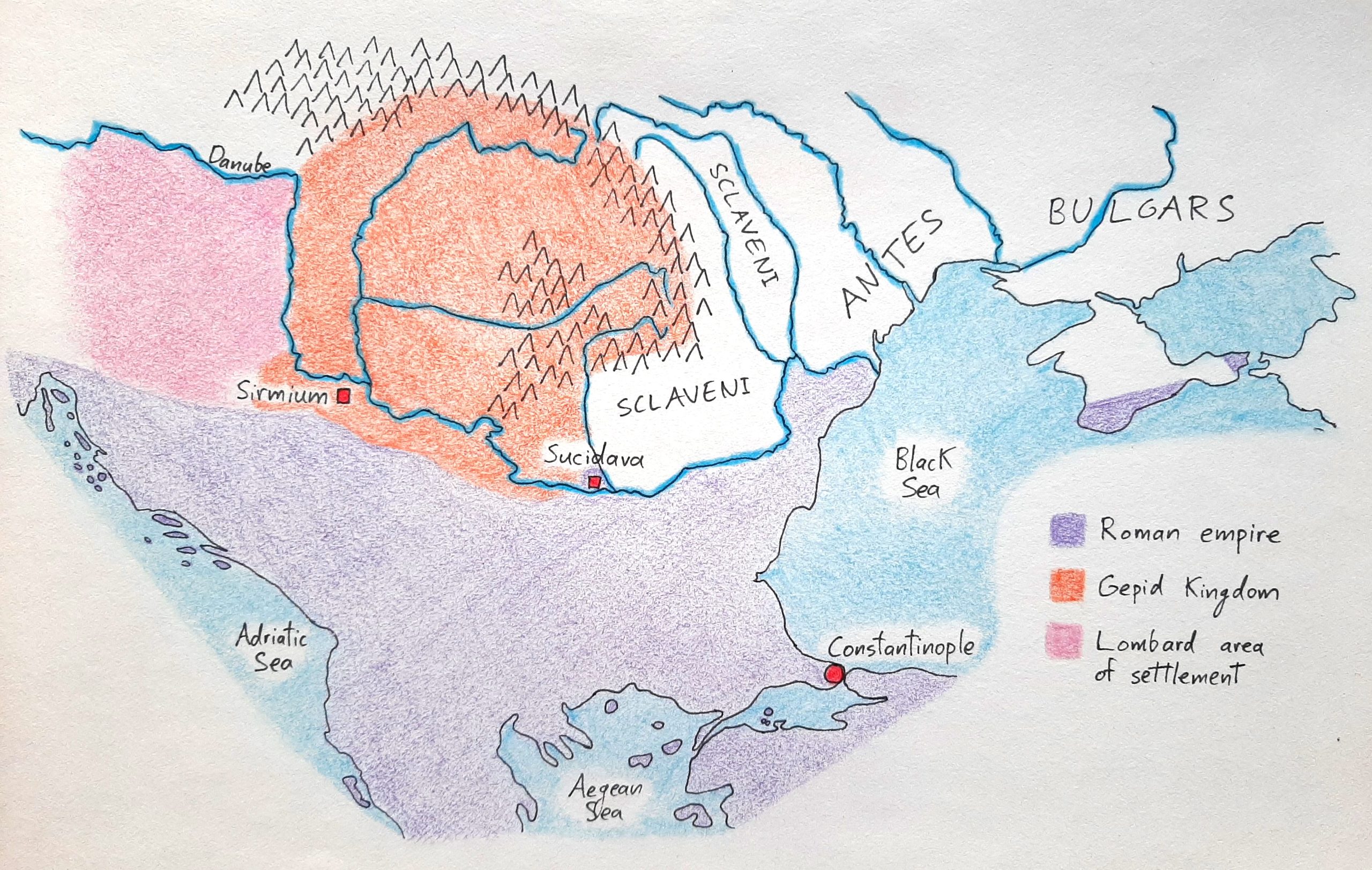
493 CE – The Gepid kingdom
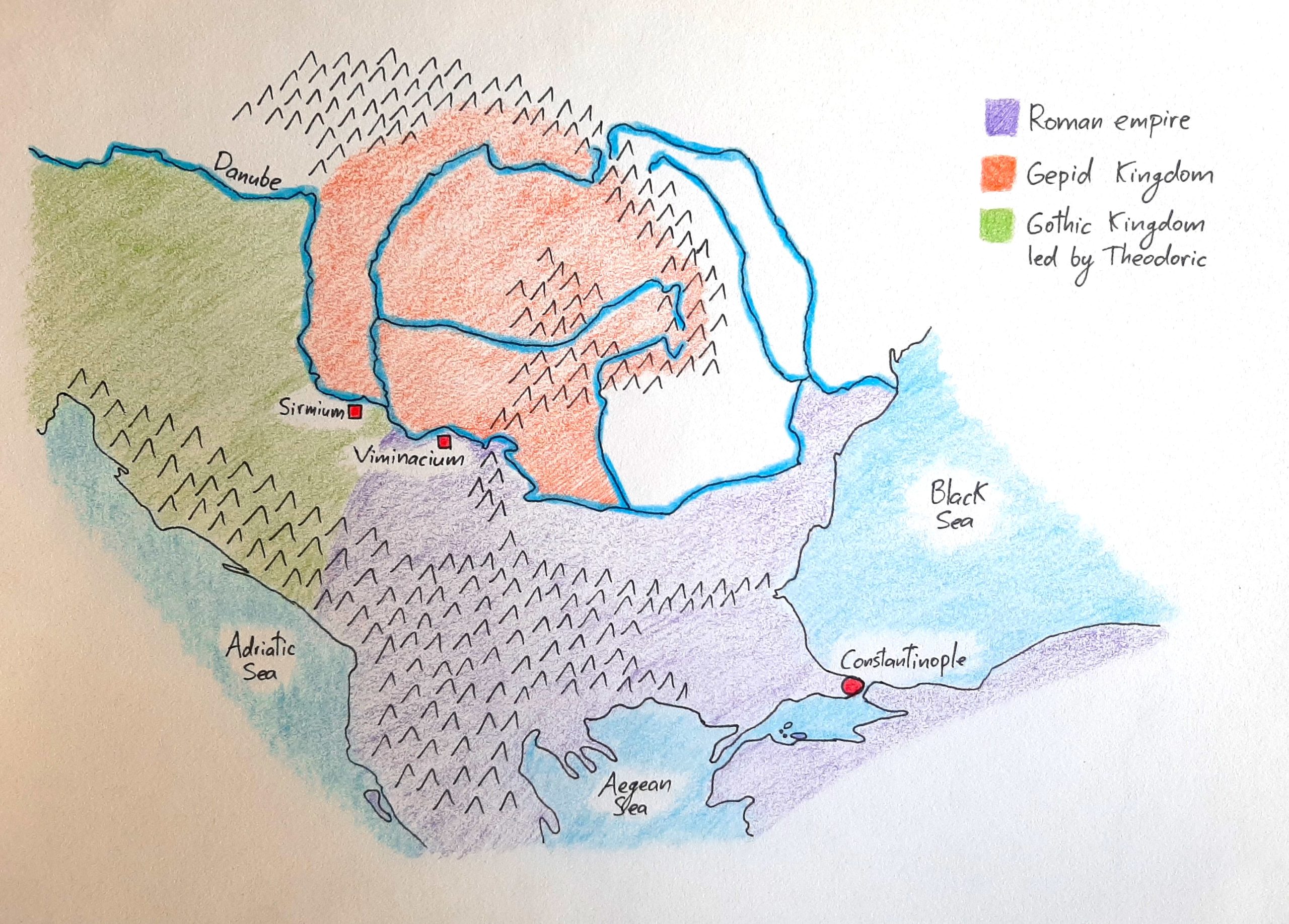
Below is a map of what the Balkans looked like in 493 CE. The Gepid kingdom included the lands of the original province of Dacia, plus territory to the west and north which hadn’t been part of the Roman empire. If we take a wider view of the Mediterranean world at this moment, we see…
-
332 CE – Constantine’s conquests and the province of Gothia
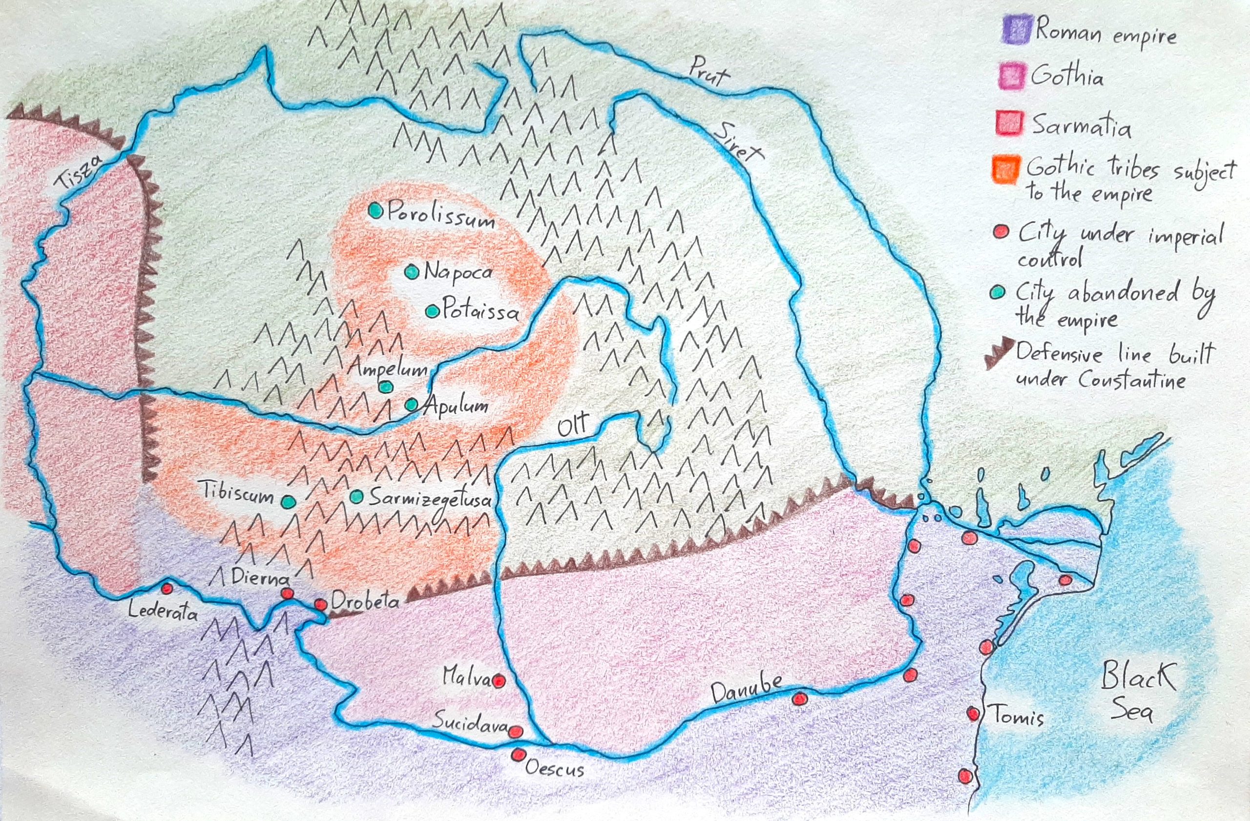
Below, you can see the Balkan portion of the Roman empire. Constantinople’s location near the Danubian frontier allowed the emperor to quickly respond to threats from that direction, but it also put the capital at risk. To strengthen the empire’s Balkan defenses, Constantine pushed his armies beyond the Danube, defeated the Sarmatian Iazyges and the…