Look through all the maps I’ve drawn for the story in chronological order.
-
300 CE – Dicoletian’s empire and cross-Danubian contact
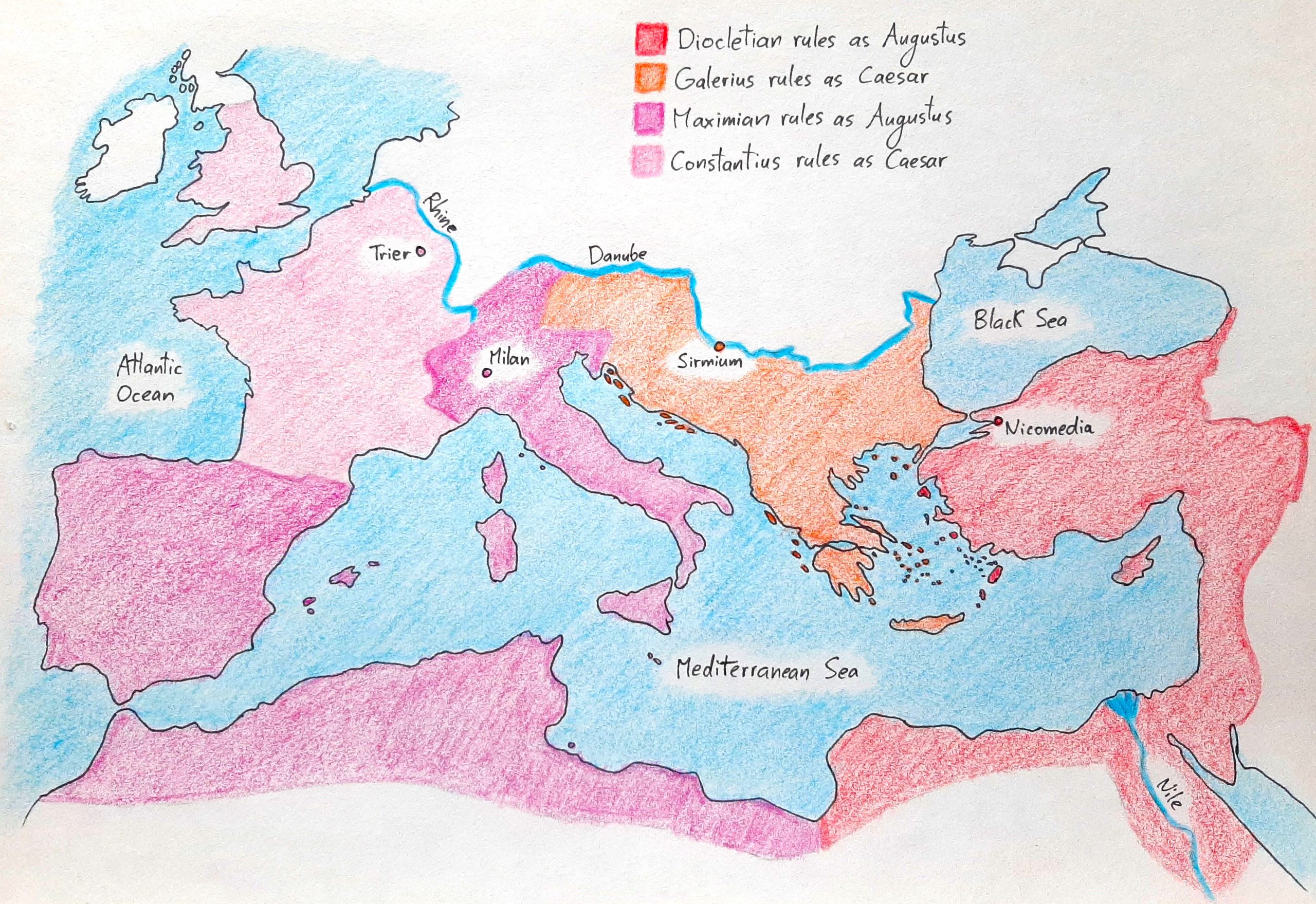
Below, you can see Diocletian’s reformed empire in the year 300 CE. The Mediterranean world was divided into four regions, each ruled by an emperor with a capital near the border. Diocletian oversaw the eastern part, which combined Anatolia, Syria, Palestine, and Egypt. His heir, Galerius, governed the Danubian district, which united Pannonia, Moesia, and Thrace.Maximian…
-
270 CE – Fragmented empire
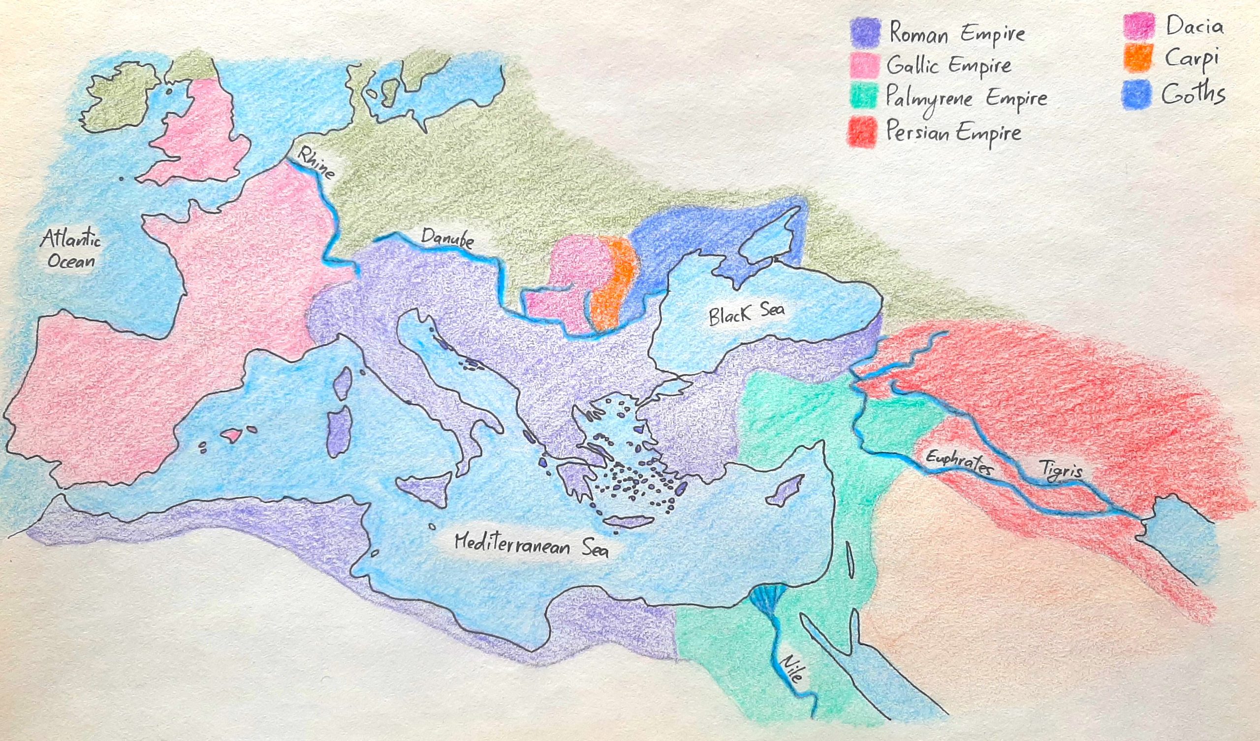
The map above shows what the Mediterranean world looked like in 270 CE: while the Roman empire retained power in the centre, a breakaway state formed around Gaul in the West, and one around Palmyra in the East. To help you better understand how our local theatre fits into the larger crisis, I’ve highlighted the…
-
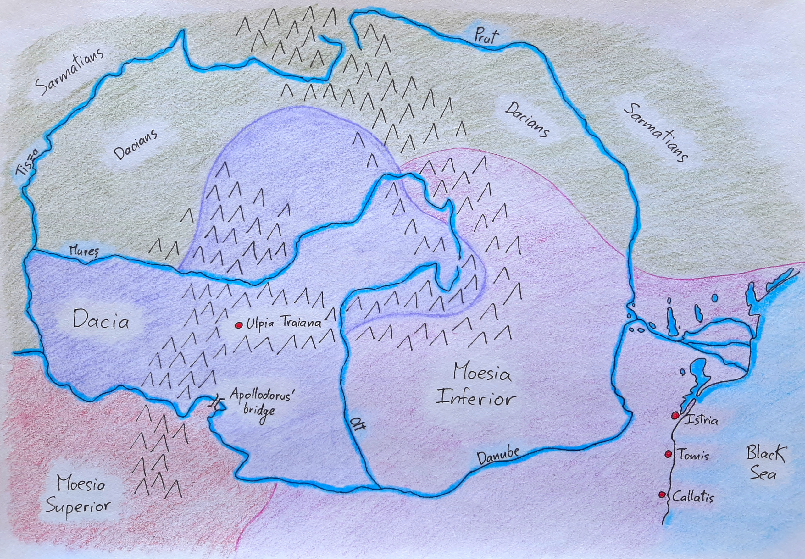
198 CE – United Dacia

Here is a look at Dacia in 198 CE after emperor Septimius Severus elevated several settlements to the status of city and expanded the borders of the province by pushing the Olt frontier to the east. The map differentiates between cities (municipium), which were urban centres with a certain degree of autonomy, and colonies (colonia),…
-
124 CE – Hadrian’s three Dacias

This is what Roman domains looked liked north of the Danube in 124 CE after Hadrian’s reorganization of the region. The empire relinquished the territory it had added to Moesia Inferior, and the Sarmatian Roxolani moved to the plains east of the Olt; there they found Dacians that had lived in the area for hundreds…
-
109 CE – Trajan’s Dacia
Here is what the Carpathian region looked like in 109 CE following Trajan’s expansion of the empire and the founding of the first Roman city north of the Danube, Colonia Ulpia Traiana Augusta Dacica.
-
101 CE – Trajan’s invasion of Dacia
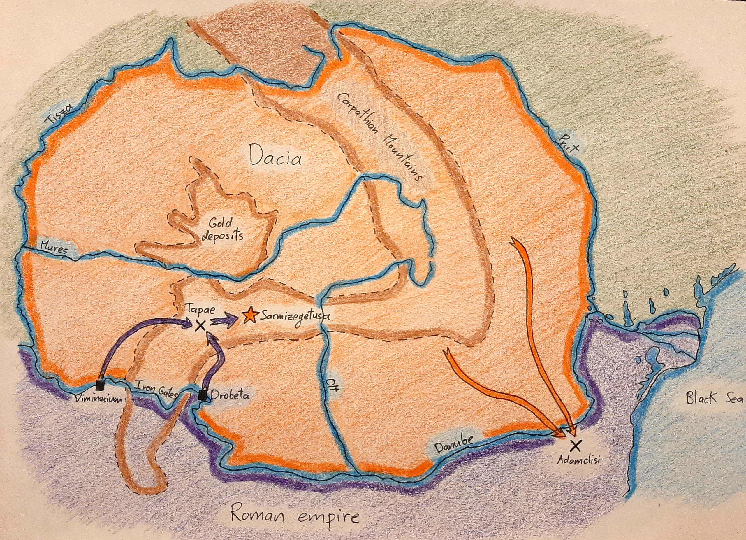
The map above shows the main sites of the Dacian wars. The Romans launched their attack from Viminacium and Drobeta, two forts on either side of the Iron Gates. The pass at Tapae protected the way to the Dacian capital of Sarmizegetusa, while the gold deposits of the kingdom lay north of the capital. The…
-
44 BCE – Burebista’s kingdom
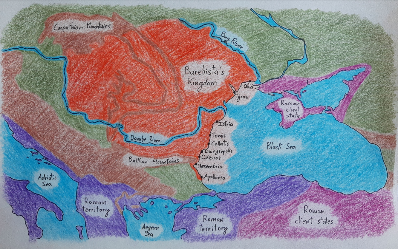
Here is Buresbista’s kingdom as well as the extent of Roman expansion in the region in 44 BCE. Keep in mind that the centre of Burebista’s power was in the southwestern Carpathian Mountains, the area just before the mountains turn south to meet the Danube River; his authority wasn’t uniform throughout the realm, and the farther…
-
520 BCE – Carpatho-Danubian area
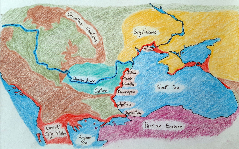
Here are the peoples living around the Black Sea in around 520 BCE, before the Persian Empire begins its Scythian expedition. It’s important to note that the coloured areas showing where the Getae and Scythians are didn’t only have Getic and Scythian tribes. There were other peoples living in those regions as well; the coloured areas are…
-
Carpatho-Danubian geography
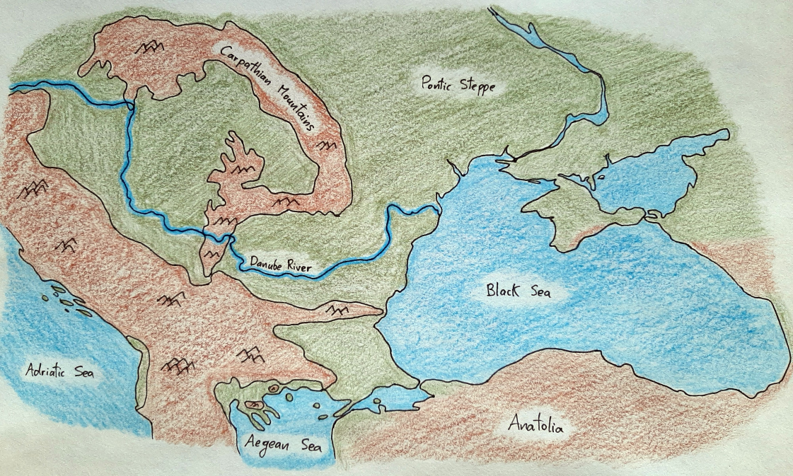
This map shows the three most important geographic features of the region we’re discussing: the Carpathian Mountains, the Danube River, and the Black Sea.