Look through all the maps I’ve drawn for the story in chronological order.
-
44 BCE – Burebista’s kingdom
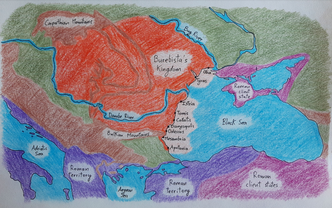
Here is Buresbista’s kingdom as well as the extent of Roman expansion in the region in 44 BCE. Keep in mind that the centre of Burebista’s power was in the southwestern Carpathian Mountains, the area just before the mountains turn south to meet the Danube River; his authority wasn’t uniform throughout the realm, and the farther…
-
520 BCE – Carpatho-Danubian area
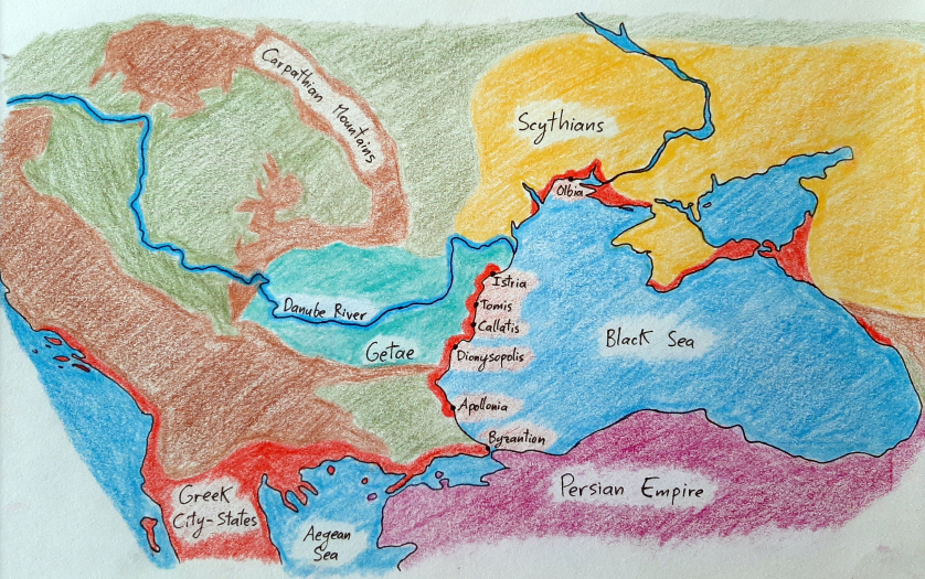
Here are the peoples living around the Black Sea in around 520 BCE, before the Persian Empire begins its Scythian expedition. It’s important to note that the coloured areas showing where the Getae and Scythians are didn’t only have Getic and Scythian tribes. There were other peoples living in those regions as well; the coloured areas are…
-
Carpatho-Danubian geography
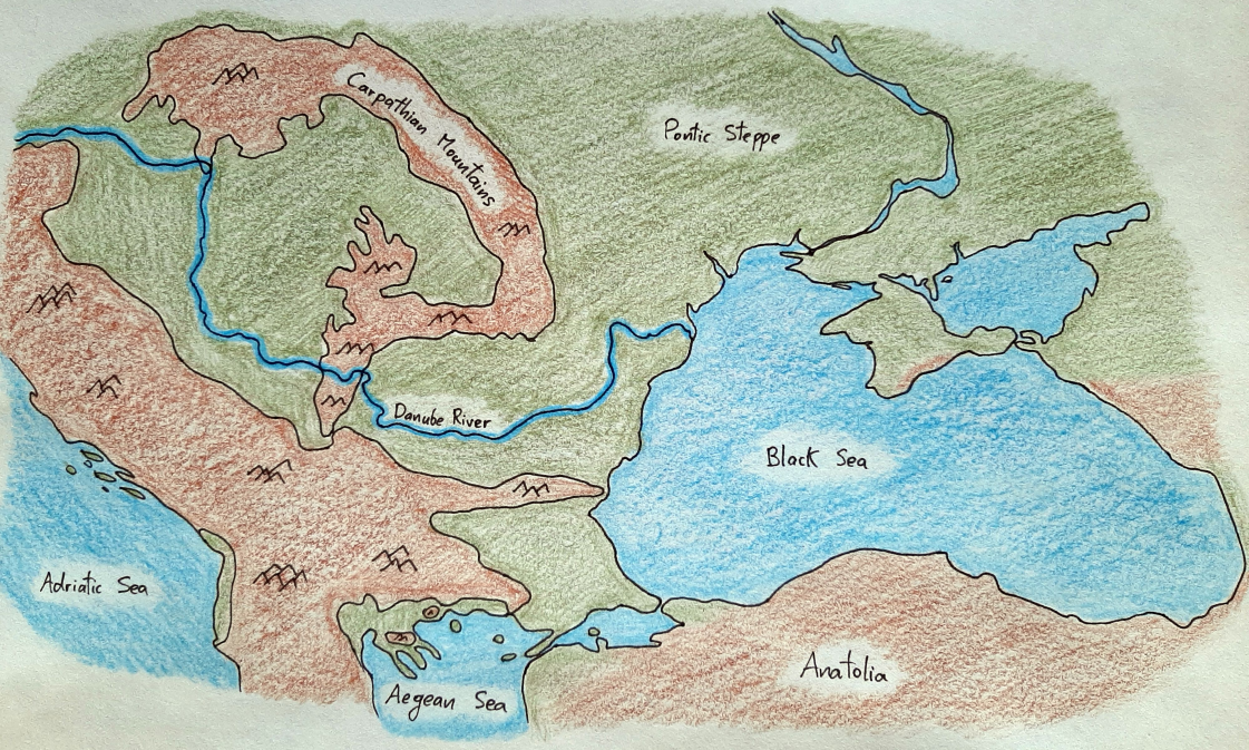
This map shows the three most important geographic features of the region we’re discussing: the Carpathian Mountains, the Danube River, and the Black Sea.