After decades of campaigning, the Frankish king had expanded his dominion from the Atlantic to the Adriatic and became the most powerful ruler in the region in centuries.
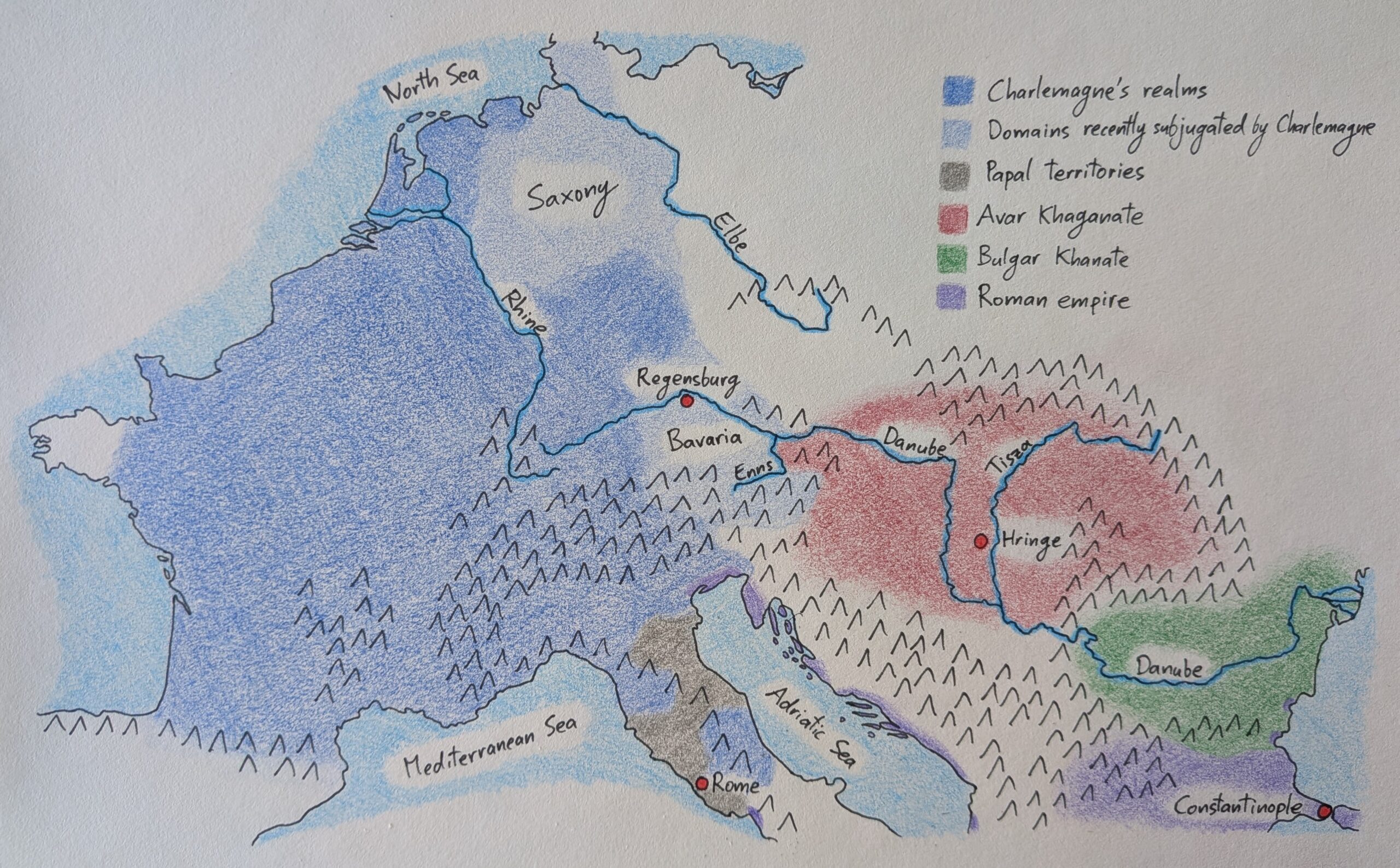
Two territories of particular interest for our story are Saxony and Bavaria. Charlemagne had campaigned against the Saxons for years until, in 785, he had defeated their armies and forced their leaders to swear fealty to him. Three years later, in 788, he had orchestrated the deposition of the duke of Bavaria, which allowed him to acquire the duchy for himself. In this way, Charlemagne had consistently pushed the boundaries of his realms further east and, inevitably, came to border the khaganate.
Charlemagne’s realms completely dwarfed the khagan’s. Their common border was the Enns river. Beyond it were forests and plains interspersed with Avar forts which protected settlements further east. In the middle of the realm, between the Danube and Tisza rivers, lay the khagan’s capital; we don’t know how the Avars referred to it, but the Franks called it the hringe, meaning “ring,” which was an allusion to its concentric fortifications.
Also worth noting on the map are the papal territories in central Italy, which had been gifted to the bishop of Rome by Charlemagne’s father. Though the pope administered these territories on his own, he was little more than a Frankish vassal; the pope depended on Charlemagne’s approval for his position as bishop of Rome and was entirely reliant on him for protection against hostile neighbours. As such, Charlemagne had a great deal of influence over the pope and could convince him to support his political ambitions with his religious authority.
Leave a Reply